Thunderstorms Impact Central Texas Counties - August 12, 2025
Additional thunderstorm activity continued across Central Texas on August 12, 2025, with separate storm cells affecting different regions between 5:58 PM and 7:15 PM CDT. The National Weather Service issued additional Special Weather Statements as these storms developed.
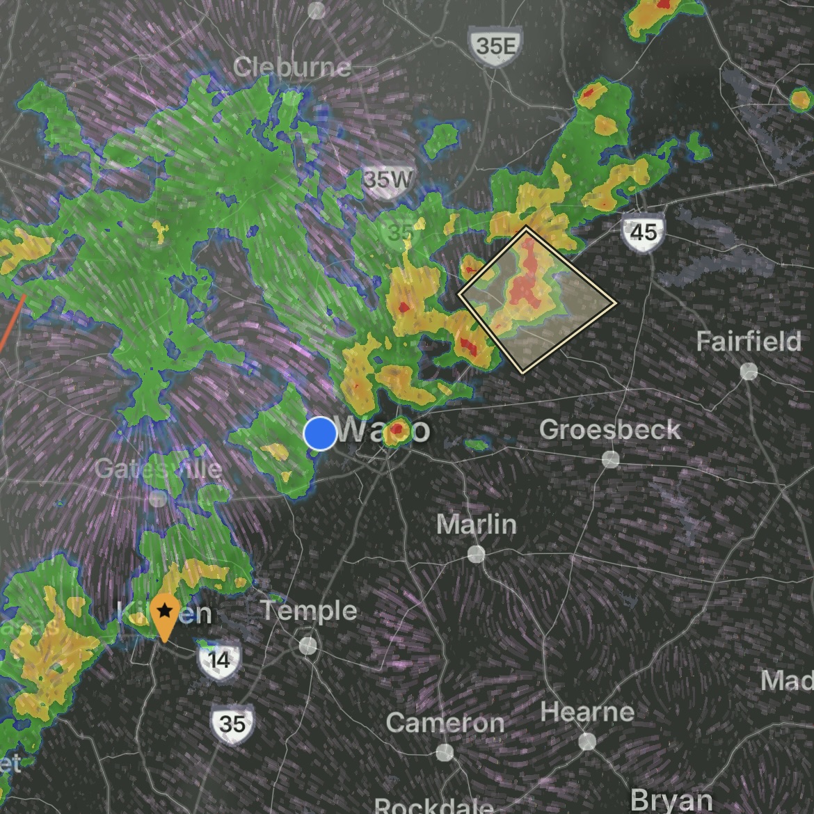
Dawson/Mexia Storm Cell (5:58-6:45 PM CDT):
A strong thunderstorm impacted portions of north central Limestone, southeastern Hill, and southwestern Navarro Counties. The storm was tracked by Doppler radar over Dawson, or 22 miles northwest of Mexia, moving northeast at 5 mph.
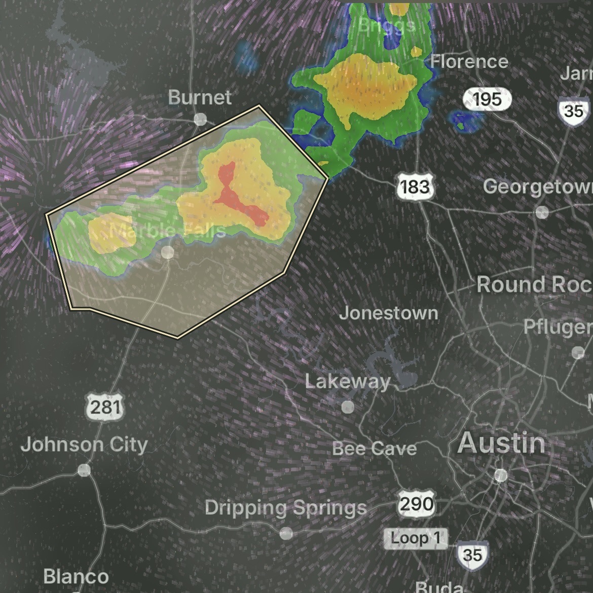
Oatmeal/Granite Shoals Storm Cell (6:34-7:15 PM CDT):
Strong thunderstorms affected portions of southeastern Llano and southwestern Burnet Counties. The storm system was detected along a line extending from near Oatmeal to Granite Shoals, moving southeast at 10 mph.
Weather Conditions:
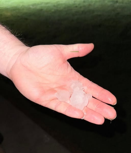
The Dawson/Mexia storm produced wind gusts up to 50 mph and pea-sized hail, while the Oatmeal/Granite Shoals storm had wind gusts up to 50 mph and half-inch hail. The larger hail size in the Oatmeal/Granite Shoals area indicates potentially more significant vehicle damage risk.
Affected Counties:
• Limestone County
• Hill County
• Navarro County
• Llano County
• Burnet County
Was your car exposed during this storm?
Hail damage isn't always visible to the untrained eye. Our certified technicians can identify damage that may not be immediately apparent.